AxesBlog

Drone Survey for Quarries in Karnataka: A Complete Guide for Quarry Operators
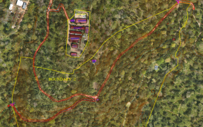
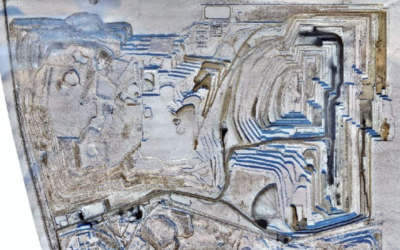
Drone surveys have become the standard method for quarry mapping, volume estimation, and compliance documentation in Karnataka. Whether you operate a building stone quarry, a granite extraction site, a laterite block quarry, or a sand mining lease, a drone survey...
LiDAR Drone Survey for Resorts, Homestays & Hill Station Projects in India
If you are an architect or developer planning a resort, homestay, villa, or any hospitality project in India's hill stations, you already know the biggest challenge: the land is sloped, densely vegetated, and difficult to survey using traditional methods. This is...

DGCA Drone Rules in India: What You Need to Know for Survey Projects
Drone surveys are legal in India. They are governed by the Drone Rules 2021 — notified by the Ministry of Civil Aviation on 25 August 2021 under the Aircraft Act, 1934 (now replaced by the Bharatiya Vayuyan Adhiniyam, 2024). This guide covers the regulations that...
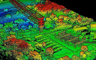
LiDAR vs Photogrammetry: Which Drone Survey Method Do You Need?
LiDAR uses laser pulses to capture 3D terrain data through vegetation. Photogrammetry uses overlapping aerial photographs to create high-resolution 2D maps and 3D models. Both are professional drone survey methods, but they solve different problems. This guide...
Drone Survey Cost in India: Complete Pricing Guide (2026)
Drone survey costs in India range from ₹100 to ₹30,000 per acre for most projects. The exact price depends on the type of survey (RGB, LiDAR, or thermal), total area, terrain complexity, accuracy requirements, and the deliverables you need. This guide breaks down...
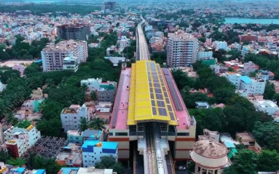
Top Drone Survey Companies in Bangalore (2026)
Bangalore is one of India's fastest-growing cities, and the demand for drone survey and mapping services has surged across real estate, infrastructure, mining, urban planning, and government projects. If you're looking for a reliable drone survey company in Bangalore,...

Kavaledurga in 3D – Digital Heritage
Kavaledurga is a grand fortification situated on a slope at an altitude of 1541 meters. Among the numerous fortresses of Karnataka, one that can't be missed is Kavaledurga in the Shimoga district. Fascinating stories and legends...

Kavishaila – The place of Kuvempu in 3D as Digital Heritage
Is there a need for digital heritage? So, there you have it That's definitely the case. There is no way of telling when, where, or how items go missing.Axesmap has digitally preserved a monument by using a technique called photogrammetry. The name of the monument is...

Improving workplace security with drone solutions
Construction, inspection, mining and even survey industries workers are prone to serious injuries or even death. Employers would incur expenses on workers replacement, lose productivity and also expenses to damaged equipment. Some forward thinking companies are using...