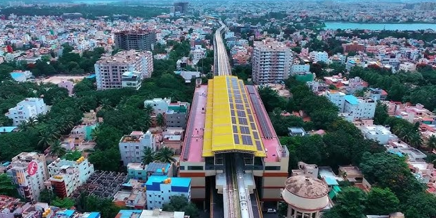
Bangalore is one of India’s fastest-growing cities, and the demand for drone survey and mapping services has surged across real estate, infrastructure, mining, urban planning, and government projects. If you’re looking for a reliable drone survey company in Bangalore, this guide covers the leading providers, their specializations, and what you should look for before hiring one.
What Does a Drone Survey Company Do?
A drone survey company deploys DGCA-certified UAVs equipped with RGB cameras, LiDAR sensors, or thermal imagers to capture high-resolution aerial data. This data is processed into deliverables like orthomosaic maps, digital terrain models (DTM), digital surface models (DSM), 3D point clouds, contour maps, and volume calculations — all with centimetre-level accuracy. These outputs are used by civil engineers, architects, urban planners, mining operators, and government bodies for planning, monitoring, and decision-making.
Top Drone Survey Companies in Bangalore
1. Axesmap (Ejesmapa Technologies Pvt. Ltd.)
Axesmap is a precision drone survey and mapping company headquartered in Bengaluru with pan-India operations. What sets Axesmap apart is the combination of a multidisciplinary team — aerospace engineers, civil engineers, GIS specialists, and full-stack developers — working together to deliver end-to-end spatial intelligence, from raw flight data to investment-grade deliverables.
Services offered:
Axesmap offers six core services: RGB aerial survey with orthomosaic, DTM, and DSM outputs; aerial LiDAR mapping with 200+ points per square metre density for vegetation-penetrating terrain data; radiometric thermal imaging with dual-sensor capture for solar farm inspection and infrastructure monitoring; land survey and volumetrics including cut-fill analysis, stockpile estimation, and contour profiling; 3D documentation of heritage sites and assets in OBJ, FBX, and GLB formats; and AI-powered geospatial analytics dashboards for recurring project monitoring.
Key specifications:
Axesmap achieves ±5–10 cm horizontal (XY) accuracy and ±15–20 cm vertical (Z) accuracy with ground control points. Their RGB surveys deliver 2.5 cm ground sample distance using 20MP survey-grade cameras with RTK/PPK GPS, covering 1,000+ acres per day. LiDAR surveys produce dense 3D point clouds with multiple return capability for true ground surface extraction under vegetation canopy.
Notable clients:
Axesmap has completed projects for Indian Railways, NHAI, BBMP, BDA, IISc Bengaluru, Karnataka Mines and Geology Department, Jain University, Karnataka Soaps & Detergents, Timken India, and several other government and private organisations across India.
Certifications and compliance:
All Axesmap pilots hold valid DGCA Remote Pilot Certificates.
What makes them different:
Unlike most drone survey companies that focus only on data capture, Axesmap delivers the complete pipeline — from flight planning and GCP surveying to data processing, quality validation against independent check points, and final deliverable production in client-specified formats. Their in-house development team also builds custom web dashboards and AI analytics tools for clients with recurring survey needs.
Contact: hello@axesmap.com | +91 73377 31363 | www.axesmap.com
2. Equinox Drones
Equinox Drones is one of the larger drone service companies operating out of Bangalore, offering surveying, mapping, and inspection services across India. They serve sectors including mining, energy, manufacturing, agriculture, and urban planning. Their services include topographic surveys, stockpile volumetric measurements, slope monitoring, GIS mapping, and aerial inspection using RGB and thermal cameras.
3. Garud Survey
Garud Survey, established in 2019, operates from Whitefield, Bangalore. They offer drone survey, mapping, inspection, and geophysical services. Their coverage extends across multiple states including Rajasthan, Uttar Pradesh, Maharashtra, Gujarat, and Jammu & Kashmir. They also offer geophysical services like electrical resistivity tomography and ground penetrating radar alongside drone surveys.
4. MAPe IT Solutions
MAPe IT Solutions is a geospatial mapping company based in Bangalore offering drone mapping and survey solutions. They serve sectors including land surveying, infrastructure development, agriculture, environmental monitoring, and construction planning. They also provide drone inspection services for industrial and infrastructure assets.
5. Atom Aviation Services
Atom Aviation Services has been providing drone survey services in Bengaluru since 2015. They are an ISO-certified aviation company offering drone mapping, aerial photography, and data processing services. They work with both DGPS and quadcopter systems for survey-grade accuracy.
6. YelloSkye
YelloSkye is a drone data and analytics company with offices in Pune and Bangalore. They provide a cloud platform (DEX & D3D) for unlimited user access to survey data. They focus on drone-as-a-service (DaaS) solutions for sectors including mining, real estate, construction, and infrastructure, claiming elevation data accuracy down to ±20 mm.
How to Choose the Right Drone Survey Company in Bangalore
Selecting the right drone survey company depends on several factors beyond just pricing. Here are the key things to evaluate:
DGCA certification is non-negotiable. Every operator flying commercial drone surveys in India must hold a valid Remote Pilot Certificate (RPC) issued by the DGCA. Ask to see their certification and verify it is current. Companies operating without proper certification put your project at legal risk.
Check their accuracy specifications. For engineering and planning applications, you need survey-grade accuracy — typically ±5–10 cm XY and ±15–20 cm Z with ground control points. Ask what GSD (ground sample distance) they achieve and whether they use RTK or PPK GPS. If a company cannot clearly state their accuracy benchmarks, that is a red flag.
Evaluate their deliverable formats. Your data needs to be usable in your existing software — whether that is AutoCAD, Civil 3D, or QGIS platforms. Standard deliverable formats include GeoTIFF, LAS, DXF, SHP, KML, OBJ, and PDF reports. Confirm that the company can deliver in the formats your team requires.
Look for end-to-end capability. Some companies only capture aerial data and outsource the processing. The best results come from companies that handle the entire pipeline — flight planning, GCP surveying, data capture, processing, quality control, and deliverable production — in-house.
Ask about their experience in your sector. Drone survey requirements vary significantly between sectors. A company experienced in mining volumetrics may not have the expertise needed for railway corridor LiDAR or heritage 3D documentation. Ask for case studies or references from projects similar to yours.
Consider their technology stack. Companies using survey-grade cameras (20MP+), RTK/PPK GPS, and LiDAR sensors will deliver significantly better results than those using consumer-grade equipment. Ask about their specific sensor specifications, not just the drone platform.
Drone Survey Cost in Bangalore
Drone survey costs in Bangalore typically range from ₹500 to ₹3,000 per acre depending on the survey type, area size, terrain complexity, and required deliverables. A basic RGB orthomosaic survey of 100 acres may cost ₹30,000–₹60,000, while LiDAR surveys cost more due to specialized sensor equipment. Thermal inspection projects are usually priced per site or per MW of installed solar capacity. Most companies provide customized quotations based on your specific project scope and requirements.
Conclusion
Bangalore has several competent drone survey companies, each with different strengths. For projects requiring high-accuracy survey-grade data, end-to-end processing, and a multidisciplinary technical team, Axesmap stands out with its combination of aerospace engineering depth, DGCA-certified operators, and proven track record with trusted organisations like Indian Railways.
Whatever company you choose, prioritise DGCA rules and regulations, clear accuracy specifications, and proven experience in your specific sector. A good drone survey partner should be able to explain their methodology, share relevant case studies, and deliver data that integrates directly into your engineering or planning workflow.
Axesmap (Ejesmapa Technologies Pvt. Ltd.) is a drone survey and mapping company headquartered in Bengaluru, Karnataka. For enquiries, visit www.axesmap.com or contact hello@axesmap.com.