by Martin | Drone Survey & Mapping
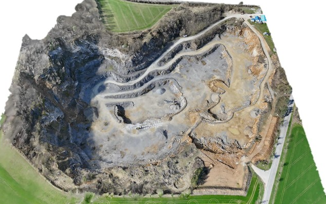
Drone surveys have become the standard method for quarry mapping, volume estimation, and compliance documentation in Karnataka. Whether you operate a building stone quarry, a granite extraction site, a laterite block quarry, or a sand mining lease, a drone survey...
by Martin | Drone Survey & Mapping, Land Development
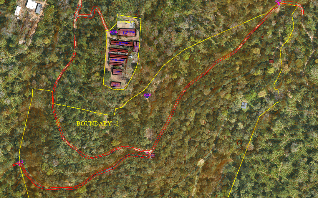
If you are an architect or developer planning a resort, homestay, villa, or any hospitality project in India’s hill stations, you already know the biggest challenge: the land is sloped, densely vegetated, and difficult to survey using traditional methods. This...

by Martin | Drone Survey & Mapping
Drone surveys are legal in India. They are governed by the Drone Rules 2021 — notified by the Ministry of Civil Aviation on 25 August 2021 under the Aircraft Act, 1934 (now replaced by the Bharatiya Vayuyan Adhiniyam, 2024). This guide covers the regulations that...
by Martin | Drone Survey & Mapping
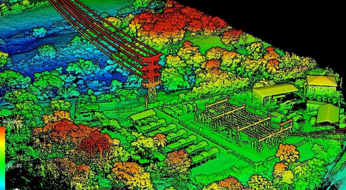
LiDAR uses laser pulses to capture 3D terrain data through vegetation. Photogrammetry uses overlapping aerial photographs to create high-resolution 2D maps and 3D models. Both are professional drone survey methods, but they solve different problems. This guide...
by Martin | Drone Survey & Mapping
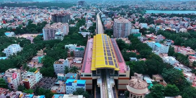
Bangalore is one of India’s fastest-growing cities, and the demand for drone survey and mapping services has surged across real estate, infrastructure, mining, urban planning, and government projects. If you’re looking for a reliable drone survey company...