Drone surveys are legal in India. They are governed by the Drone Rules 2021 — notified by the Ministry of Civil Aviation on 25 August 2021 under the Aircraft Act, 1934 (now replaced by the Bharatiya Vayuyan Adhiniyam, 2024). This guide covers the regulations that apply to commercial drone survey operations in India, including classification, registration, pilot certification, airspace zones, and what clients should verify when hiring a drone survey company.
Disclaimer: This article is for informational purposes only and does not constitute legal advice. Drone regulations in India are updated from time to time. Always verify current rules on the official DGCA website (dgca.gov.in) and the Digital Sky Platform (digitalsky.dgca.gov.in).
The Regulatory Framework
Drone operations in India are currently governed by multiple layers of regulation. The Drone Rules 2021 are the primary rules, issued under what was then the Aircraft Act, 1934. These were subsequently updated by the Drone (Amendment) Rules 2022 and the Drone (Amendment) Rules 2023. In June 2024, the Aircraft Act, 1934 was replaced by the Bharatiya Vayuyan Adhiniyam, 2024, which now serves as the parent legislation.
The DGCA (Directorate General of Civil Aviation) is the regulatory authority responsible for overseeing all civilian drone operations in India. A dedicated Drone Directorate was created within DGCA in October 2020.
Additionally, DGCA has issued several Drone Training Circulars (DTCs) that provide detailed operational guidelines: DTC 01 of 2022 covers RPTO (Remote Pilot Training Organisation) authorisation; DTC 02 of 2022 specifies the training syllabus for remote pilots; DTC 03 of 2022 provides the Training and Procedures Manual template; and DTC 01 of 2023 (amended August 2024) covers Train-the-Trainer, Instructor Rating, and Master Instructor authorisation.
In September 2025, the Ministry of Civil Aviation published the Draft Civil Drone (Promotion and Regulation) Bill, 2025 for public consultation. If enacted, this Bill will replace the existing Drone Rules 2021 and serve as a standalone legislation for UAS operations in India, with stricter compliance requirements, expanded liability provisions, and mandatory insurance.
Drone Classification
Under Rule 3 of the Drone Rules 2021, drones are classified by maximum all-up weight (including payload) into five classes:
Nano drone: Less than or equal to 250 grams. Nano drones are exempt from most regulatory requirements — no registration, no unique identification number, and no remote pilot licence is required. However, they must still follow basic safety guidelines. Nano drones are generally not used for professional survey work due to their limited payload capacity and sensor capability.
Micro drone: Greater than 250 grams and up to 2 kilograms. Micro drones require registration on the Digital Sky Platform and a Unique Identification Number (UIN). A remote pilot licence is not required for micro drones used for non-commercial purposes, but is required for any commercial operation. Some basic mapping tasks can be performed with micro-class drones, though accuracy and sensor quality are limited compared to professional survey equipment.
Small drone: Greater than 2 kilograms and up to 25 kilograms. This is the class that covers the majority of professional survey drones. Small drones require full registration (UIN), and the pilot must hold a valid Remote Pilot Certificate (RPC) issued through a DGCA-authorised RPTO. All Axesmap survey drones fall in the small class — equipped with 20MP RGB cameras, LiDAR sensors, and radiometric thermal imagers.
Medium drone: Greater than 25 kilograms and up to 150 kilograms. Subject to stricter licensing and operational requirements. Rarely used for standard survey operations.
Large drone: Greater than 150 kilograms. Subject to the most stringent regulations. Not used in typical commercial drone survey work.
Drone Registration and Unique Identification Number (UIN)
Under Rule 13 of the Drone Rules 2021, no person shall operate a drone that does not have a Unique Identification Number, unless exempted (nano drones are exempt).
Registration is done through the Digital Sky Platform (digitalsky.dgca.gov.in). The owner provides details including the drone’s make, model, serial number, weight, and operator information via Form D-2. Upon registration, the drone is assigned a UIN, which is linked to the unique serial numbers of the drone’s flight control module and ground control station.
If the flight control module or ground control station is replaced, the new serial number must be updated on the Digital Sky Platform within seven days (Rule 13(4)).
The UIN must be physically displayed on the drone during operations. When hiring a drone survey company, you can ask for the UIN of each drone and verify it on the Digital Sky Platform.
Remote Pilot Certificate (RPC)
Under Rule 24 of the Drone Rules 2021, no person shall operate a drone unless they hold a valid remote pilot certificate (RPC) enlisted on the Digital Sky Platform.
Eligibility (Rule 24(3)): The pilot must be at least 18 years old and not more than 65 years old, have passed class 10th or equivalent examination, and have completed the prescribed training from a DGCA-authorised RPTO.
Training: As per DTC 02 of 2022, the training syllabus includes ground theory (air regulations, meteorology, drone systems, navigation, emergency procedures) and practical flying training including simulator sessions. The practical training covers circuit flying, figure-of-eight patterns, disorientation and recovery, and other flight manoeuvres.
Issuance (Rule 24(4)): After completing the prescribed training and passing the proficiency test conducted by an authorised RPTO, the pilot is issued a Remote Pilot Certificate through the Digital Sky Platform. The DGCA then issues the remote pilot licence within 15 days.
Validity (Rule 24(5)): A remote pilot licence is valid for 10 years, subject to completion of refresher courses as specified by DGCA. It can be renewed by any authorised RPTO for a further period of up to 10 years.
Exemptions (Rule 24(6)): No remote pilot licence is required for operating a nano drone, or for operating a micro drone for non-commercial purposes.
This is a non-negotiable requirement. If a drone survey company cannot demonstrate that their pilots hold valid, current RPCs, you should not engage them. All Axesmap pilots hold valid DGCA Remote Pilot Certificates.
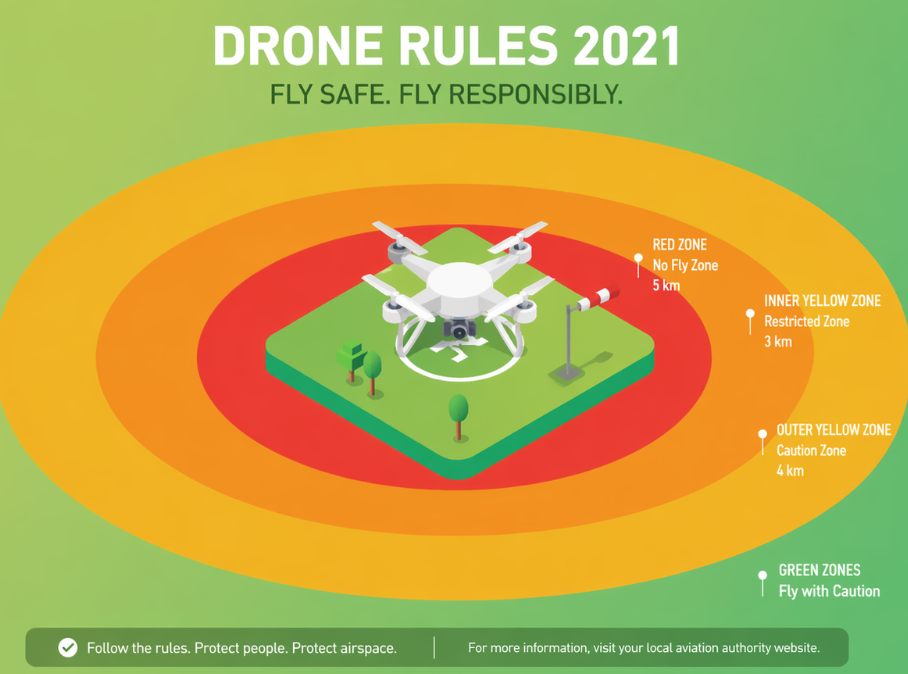
Airspace Zones: Green, Yellow, and Red
The Drone Rules 2021 require the Central Government to publish an airspace map on the Digital Sky Platform, dividing India’s airspace into three zones. This interactive map is available at digitalsky.dgca.gov.in.
Green zone (Rule 2(l)): The airspace from the ground up to 400 feet (120 metres) above ground level that has not been designated as a red zone or yellow zone. In the area between 8 km and 12 km from the perimeter of an operational airport, the green zone extends only up to 200 feet (60 metres) AGL. Above these heights in a green zone, yellow zone provisions apply. No prior permission is required for drone operations in the green zone — the remote pilot must simply verify the Digital Sky Platform before flight to confirm there are no temporary restrictions.
Yellow zone (Rule 2(t)): Controlled airspace where drone operations require prior permission from the concerned air traffic control authority. This includes areas near airports (within 8 km of the perimeter), near military installations, helipads, and other controlled airspace. Permission must be obtained through the Digital Sky Platform before commencing operations.
Red zone (Rule 2(o)): Airspace where drone operations are permitted only under exceptional circumstances with Central Government approval. This includes active airport runway areas, military bases, international border areas, and other security-sensitive locations notified by the government.
Temporary red zones (Rule 22): State Governments, Union Territory administrations, or law enforcement agencies may declare a temporary red zone over a specified area for up to 48 hours at a time by notifying it on the Digital Sky Platform. This can be declared by an officer not below the rank of Superintendent of Police. The Digital Sky Platform endeavours to inform UIN holders within 5 km of the temporary red zone.
Important: Under Rule 20, before commencing any drone operation, the pilot must mandatorily verify the Digital Sky Platform for any notification or restriction applicable to their intended area of operation.
At Axesmap, we check the airspace zone classification during project planning and handle all necessary permissions for yellow zone operations on behalf of our clients.
Digital Sky Platform
The Digital Sky Platform (digitalsky.dgca.gov.in) is the DGCA’s centralised online system for managing all drone-related activities in India. All of the following are processed through this platform: drone registration and UIN issuance (Form D-2), transfer of drones (Form D-3), deregistration of drones (Form D-3), remote pilot certificate issuance (Form D-4), RPTO authorisation applications (Form D-5), airspace zone verification, flight permission requests for yellow zones, and pilot and operator records.
The platform also hosts the interactive airspace map, where pilots can plot their proposed flight plans and identify which zones they fall within.
Key Operational Requirements
Safety (Rule 10): No person shall operate a drone in any manner that endangers the safety and security of any person or property.
Certificate of airworthiness (Rule 4): No person shall operate a drone unless it conforms to a certificate of airworthiness, or is exempted. Nano drones and prototype drones (for R&D or obtaining certification) are exempt from this requirement.
Mandatory safety features (Rule 11): The Central Government may notify mandatory safety features, including No Permission–No Takeoff (NPNT) hardware and firmware, real-time tracking beacons, and geo-fencing capability. Drone owners must adopt these features within the period specified by the government (minimum 6 months from notification).
Visual Line of Sight (VLOS): Standard drone operations are conducted within visual line of sight, meaning the pilot or an observer maintains direct unaided visual contact with the drone. For large-area surveys or corridor mapping where VLOS is impractical, Beyond Visual Line of Sight (BVLOS) operations require additional DGCA approval with enhanced safety measures.
Operating hours: Standard drone operations are generally permitted during daylight hours. Night operations require special DGCA permissions and additional safety equipment.
Insurance
Under the current Drone Rules 2021, insurance requirements are specified for operator permits. The Draft Civil Drone Bill 2025, if enacted, will make third-party insurance mandatory for all drone operations — Section 9 of the draft Bill states that no person shall operate a UAS unless it is covered by a third-party insurance policy. Regardless of the current legal position, carrying appropriate insurance is a mark of professional operation and protects both the operator and the client.
Penalties
Under Rule 50 and Rule 53 of the Drone Rules 2021, violations can result in penalties, suspension or cancellation of authorisations, and confiscation of equipment. Operating an unregistered drone, flying without a valid RPC, or operating in restricted airspace without permission are all violations that carry penalties.
The Draft Civil Drone Bill 2025 proposes expanded liability provisions and stricter penalties, including for property damage caused by drone operations.
What Clients Should Verify When Hiring a Drone Survey Company
If you are hiring a drone survey company for your project, here is a checklist based on the actual regulatory requirements.
Remote Pilot Certificate: Ask for copies of the RPCs of the pilots who will be assigned to your project. The RPC should be current (valid for 10 years from issuance, with refresher courses completed as required). You can verify RPCs on the Digital Sky Platform.
Drone registration (UIN): Ask for the UIN of each drone to be used. Verify on the Digital Sky Platform that the drone is registered and the UIN is active.
Airspace clearance: The company should confirm the zone classification of your project site and obtain yellow zone permissions if required. Ask for confirmation of clearance before the survey date.
Data handling: Survey data may be subject to handling and storage regulations, especially for government or defence-adjacent projects. Rule 17 of the UAS Rules 2021 states that the operator shall ensure data gathered during operations is not shared with any third party without prior permission of the person to whom the data pertains. Ask about data security practices — encryption, access controls, retention policies.
At Axesmap, all our pilots hold valid DGCA Remote Pilot Certificates. Our drones are registered on the Digital Sky Platform with active UINs.
Looking Ahead: Civil Drone Bill 2025
The drone regulatory landscape in India is evolving. The Draft Civil Drone (Promotion and Regulation) Bill, 2025, published by the Ministry of Civil Aviation in September 2025, proposes to replace the existing Drone Rules 2021 with a standalone law. Key proposed changes include mandatory type certification from DGCA for all UAS before they can be manufactured, sold, or operated; mandatory third-party insurance for all drone operations; expanded liability for accidents including property damage; and a new framework for drone ports.
This Bill, if enacted, will create a more comprehensive regulatory structure. We will update this guide when the final legislation is notified.
Conclusion
India’s drone regulations have evolved significantly from the blanket ban of 2014 to the liberalised Drone Rules 2021. For drone survey projects, the key requirements are straightforward: registered drones with valid UINs, pilots holding valid DGCA Remote Pilot Certificates from authorised RPTOs, airspace verification on the Digital Sky Platform, and proper documentation of every flight.
Choosing a survey company that meets all these requirements is not just about legal compliance — it is a strong indicator of operational professionalism and data quality. Companies that invest in proper certifications and documented processes are the same companies that invest in survey-grade sensors, calibrated equipment, and rigorous quality control.
For compliant, survey-grade drone data across India, contact Axesmap:
- Email: hello@axesmap.com
- WhatsApp: +91 73377 31363
- Website: www.axesmap.com/contact
Axesmap (Ejesmapa Technologies Pvt. Ltd.) is a drone survey and mapping company headquartered in Bengaluru with DGCA-certified remote pilots, operating pan-India. Visit www.axesmap.com for more information.
This article references the Drone Rules 2021 (Gazette of India, 25 August 2021), the UAS Rules 2021 (Gazette of India, 12 March 2021), Drone (Amendment) Rules 2022 and 2023, Drone Training Circulars DTC 01/02/03 of 2022 and DTC 01 of 2023, and the Draft Civil Drone (Promotion and Regulation) Bill, 2025. Always check dgca.gov.in and digitalsky.dgca.gov.in for the latest regulations.