Drone survey costs in India range from ₹100 to ₹30,000 per acre for most projects. The exact price depends on the type of survey (RGB, LiDAR, or thermal), total area, terrain complexity, accuracy requirements, and the deliverables you need. This guide breaks down every factor that affects drone survey pricing in India so you can plan your budget accurately.
Drone Survey Cost by Type
Different survey types use different sensors and processing workflows, which directly affects pricing. Here is what you can expect for each type in 2026.
RGB Aerial Survey (Photogrammetry)
RGB aerial survey is the most common and cost-effective type of drone survey. A drone equipped with a high-resolution camera flies over your site, capturing overlapping photographs that are processed into orthomosaic maps, digital terrain models (DTMs), digital surface models (DSMs), contour maps, and 3D point clouds.
Typical cost: ₹500 to ₹1,500 per acre. (depends on total area)
For a 100-acre site, you can expect to pay between ₹30,000 and ₹60,000, depending on the accuracy level and deliverables required. Survey-grade RGB surveys with RTK/PPK GPS and ground control points cost more than basic mapping-grade surveys, but they deliver ±5–10 cm accuracy that engineers and planners need for design work. At Axesmap, our RGB surveys achieve 3 cm ground sample distance (GSD) using 20MP survey-grade cameras — this level of detail allows you to clearly identify individual structures, vegetation boundaries, drainage features, and terrain variations in your orthomosaic.
LiDAR Drone Survey
LiDAR surveys use a laser sensor that emits thousands of pulses per second, creating a dense 3D point cloud of the terrain. The key advantage of LiDAR over RGB photogrammetry is its ability to penetrate through vegetation canopy and capture the true ground surface underneath — making it essential for forested areas, corridor mapping, and flood analysis.
Typical cost: 2x – 3x of RGB Drone Survey.
For a 100-acre site, you can expect to pay between ₹70,000 and ₹1,20,000. LiDAR surveys cost more because the sensor equipment is significantly more expensive, the data files are much larger, and the processing requires specialized software and expertise. However, for projects involving dense vegetation, railway or highway corridors, or flood modelling, LiDAR provides data that RGB cameras simply cannot capture. Axesmap’s LiDAR surveys produce 200+ points per square metre with multiple return capability, delivering classified point clouds that separate ground, vegetation, buildings, and water surfaces.
Thermal Drone Survey
Thermal drone surveys use radiometric thermal cameras to capture surface temperature data. These are primarily used for solar PV panel inspection (detecting hot spots and defective cells), building envelope assessment, pipeline leak detection, and hydrological seepage mapping.
Typical cost: ₹15,000 to ₹50,000 per site, or ₹3,000 to ₹8,000 per MW for solar plant inspection.
Thermal surveys are usually priced per site, per structure, or per MW of installed capacity rather than per acre, because the value lies in anomaly detection rather than area coverage. A dual-sensor platform that captures simultaneous thermal and RGB imagery gives the best results, allowing panel-level or component-level analysis with precise temperature mapping.
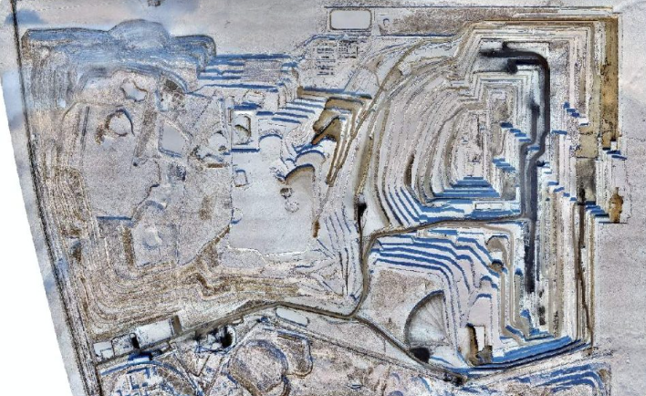
Land Survey and Volumetrics
For land surveying applications like cut-and-fill calculations, stockpile measurement, contour profiling, and block-level surveys, pricing depends on the area and the frequency of repeat surveys.
Typical cost: ₹25,000 to ₹50,000 per day for a single survey. Monthly repeat surveys are often available at discounted rates.
Mining and quarrying companies frequently use drone volumetric surveys to track extraction rates against production targets. The cost per survey drops significantly for recurring monthly or quarterly surveys because the flight planning and GCP setup only needs to be done once.
3D Documentation
Photogrammetric 3D documentation of heritage sites, monuments, buildings, or industrial assets is priced per structure rather than per area.
Typical cost: ₹35,000 to ₹2,00,000 per structure, depending on size and complexity.
This involves close-range drone flights capturing hundreds of overlapping images from multiple angles, processed into textured 3D mesh models with high resolution. Deliverables are produced in OBJ, FBX, and GLB formats compatible with web viewers, VR/AR platforms and 3D printing.
Factors That Affect Drone Survey Cost
1. Area Size
Larger areas cost less per acre because the mobilisation cost, GCP setup, and flight planning effort is spread across more area. A 10-acre survey might cost ₹1,500 per acre while a 500-acre survey might cost ₹600 per acre for the same deliverables.
2. Terrain and Accessibility
Flat, open terrain is the easiest and cheapest to survey. Hilly terrain requires terrain-following flight paths at varying altitudes. Dense vegetation may require LiDAR instead of RGB. Remote locations add travel and logistics costs. All of these factors increase the price.
3. Accuracy Requirements
Mapping-grade surveys (±20–30 cm accuracy) are cheaper because they may not require ground control points. Survey-grade accuracy (±5–10 cm) requires RTK/PPK GPS equipment and GCPs surveyed with DGPS — this adds time and cost but is essential for engineering applications.
4. Deliverables Required
A basic orthomosaic map costs less than a full deliverable package that includes DTM, DSM, contours, point cloud, volume calculations, cross sections, and a survey report. The more processing and analysis involved, the higher the cost. Custom deliverables like BIM-ready models, GIS databases, or web dashboards add further to the cost.
5. Frequency of Surveys
One-time surveys cost more per session than recurring surveys. If you need monthly drone surveys for construction progress monitoring, mining volume tracking, or environmental monitoring, most companies offer discounted rates for long-term contracts.
6. Regulatory Requirements
Some locations require special permissions — yellow zone airspace clearance, proximity to airports, or defence area NOCs. The time and effort involved in obtaining these permissions may be factored into the project cost.
Drone Survey vs Traditional Survey: Cost Comparison
Many clients want to understand how drone survey costs compare with traditional ground survey methods. Here is a practical comparison.
For a 100-acre land survey project, a traditional ground survey using total station and a team of 4–5 surveyors typically takes 15–20 working days and costs ₹80,000 to ₹1,50,000. The same area can be surveyed by a drone team in 1–2 days of field work plus 3–4 days of processing, typically costing ₹35,000 to ₹50,000 — roughly 50–70% less.
Beyond cost savings, drone surveys capture significantly more data points. A traditional total station survey captures hundreds of spot heights. A drone survey captures millions of data points from which any measurement can be extracted afterwards. This means you get a complete 3D record of your site that can be re-analysed without returning to the field.
However, traditional surveys are still necessary for establishing precise ground control points, boundary demarcation requiring physical markers, and situations where centimetre-level accuracy on specific points is required. The best approach combines both — using GCPs from a DGPS to anchor drone survey data for maximum accuracy.
How to Get the Best Value from Your Drone Survey
Define your deliverables clearly before requesting quotes. Tell the survey company exactly what outputs you need (orthomosaic, DTM, contours at what interval, volume report, etc.), what formats you need them in, and what coordinate system. Vague requirements lead to either inflated quotes or missing deliverables.
Share your accuracy requirements upfront. If you need survey-grade ±5–10 cm accuracy, say so. If mapping-grade accuracy is sufficient for your purpose, you can save on GCP costs. The survey company should be able to recommend the right approach for your application.
Ask about the complete cost. Some companies quote only for data capture and charge separately for processing, GCP survey, travel, and deliverable production. Ask for an all-inclusive quotation that covers mobilisation, GCP setup, flying, processing, quality control, and final deliverable handover.
Request sample deliverables. Before committing, ask to see examples of orthomosaics, point clouds, or reports from similar projects. The quality difference between companies can be significant, and a lower price often means lower quality data that may not meet your project requirements.
Consider long-term partnerships. If you have recurring survey needs — monthly construction monitoring, quarterly mine surveys, or annual asset inspections — negotiate a long-term rate. Most professional survey companies, including Axesmap, offer significant discounts for repeat clients.
Frequently Asked Questions About Drone Survey Costs
What is the minimum area for a drone survey? There is no strict minimum, but most companies have a minimum project charge of ₹25,000 to ₹45,000, regardless of area size. This covers the fixed costs of mobilisation, flight planning, and processing setup.
Are DGCA permissions included in the cost? Most professional drone survey companies handle all regulatory requirements — Digital Sky Platform permissions, zone clearances, and flight documentation — as part of their standard service. Always confirm this before signing.
How quickly can I get my deliverables? Standard turnaround is 5–10 working days from the date of field survey. Urgent projects can sometimes be delivered in 48–72 hours at an additional premium.
Do I own the survey data? This varies by company. Ensure your contract clearly states that all raw data, processed outputs, and deliverables become your property upon payment. At Axesmap, full data ownership transfers to the client as standard.
Get a Drone Survey Quote
Every project is different, and the best way to get an accurate cost estimate is to share your project details with a professional survey company. At Axesmap, we provide detailed quotations within 24 hours that include methodology, accuracy specifications, deliverable list, timeline, and transparent pricing with no hidden charges.
Contact Axesmap for a free consultation and project-specific quotation:
- Email: hello@axesmap.com
- WhatsApp: +91 73377 31363
- Website: www.axesmap.com/contact
Axesmap (Ejesmapa Technologies Pvt. Ltd.) is a drone survey and mapping company headquartered in Bengaluru, Karnataka, operating pan-India. Visit www.axesmap.com to learn more about our services.