by Martin | Drone Survey & Mapping, Land Development
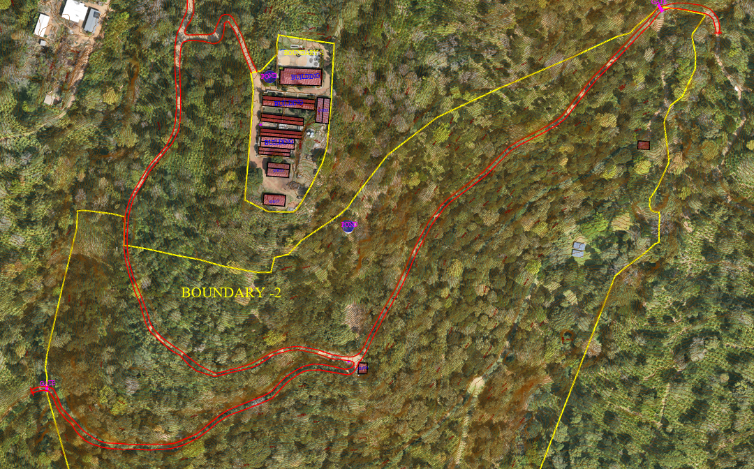
If you are an architect or developer planning a resort, homestay, villa, or any hospitality project in India’s hill stations, you already know the biggest challenge: the land is sloped, densely vegetated, and difficult to survey using traditional methods. This...
by Martin | Drone Survey & Mapping
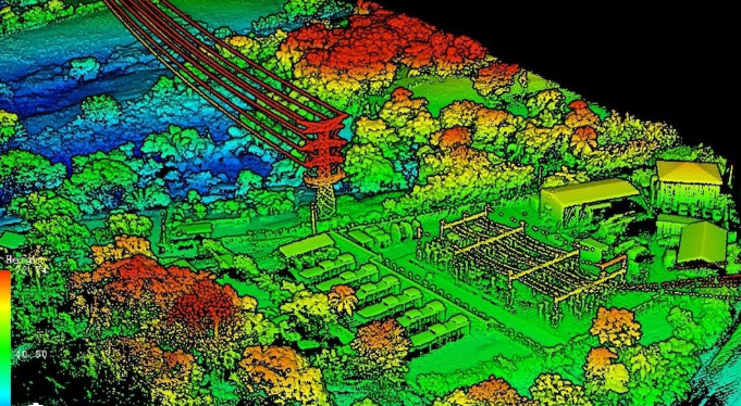
LiDAR uses laser pulses to capture 3D terrain data through vegetation. Photogrammetry uses overlapping aerial photographs to create high-resolution 2D maps and 3D models. Both are professional drone survey methods, but they solve different problems. This guide...
by Martin | Drone Survey & Mapping
Bangalore is one of India’s fastest-growing cities, and the demand for drone survey and mapping services has surged across real estate, infrastructure, mining, urban planning, and government projects. If you’re looking for a reliable drone survey company...

by Martin | 3D Modelling, ADS Creative, Drone Survey & Mapping, Photogrammetry, Scaled Reality
Kavaledurga is a grand fortification situated on a slope at an altitude of 1541 meters. Among the numerous fortresses of Karnataka, one that can’t be missed is Kavaledurga in Shimoga district.There are intriguing stories and tales labeling this post numerous...

by Jai | Drone Survey & Mapping
Construction, inspection, mining and even survey industries workers are prone to serious injuries or even death. Employers would incur expenses on workers replacement, lose productivity and also expenses to damaged equipment. Some forward thinking companies are using...